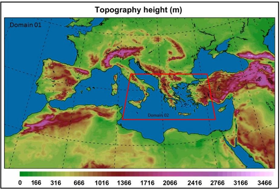
The non-hydrostatic limited area model WRF-NMM ver3.0 has been installed and configured at the parallel computational infrastructure of the Geography Department since December 2007. The model runs on a daily basis and produces a 120-hour (5 days) weather forecast for Europe and the Mediterranean basin. WRF is a reliable modeling system with high computational efficiency for the simulation of atmospheric processes (e.g. convective systems, synoptic and sub-synoptic circulation etc). Its operational execution is performed over two domains: a coarse one consisted of 305x273 grid points, on 0.09°x0.09° horizontal resolution (~12km), with time step of 30sec and 38 vertical levels up to 25mb. The nested domain is consisted of 249x269 points, covers the area of Eastern Mediterranean and Greece with a 0.03°x0.03° horizontal resolution (~4km), and a time step of 10sec. The resolution of the nested grid is the highest acquired over the Greek area on an operational basis. The two domains are shown in the following figure.
The topography of the two operational domains
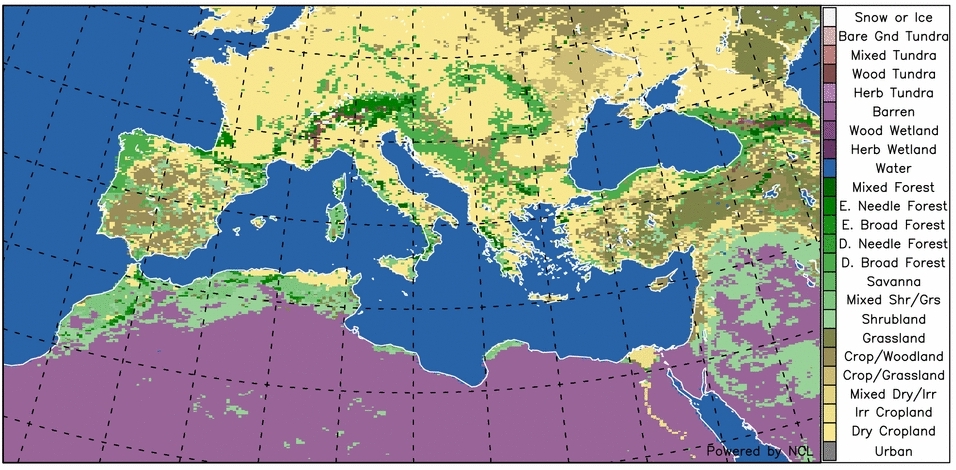
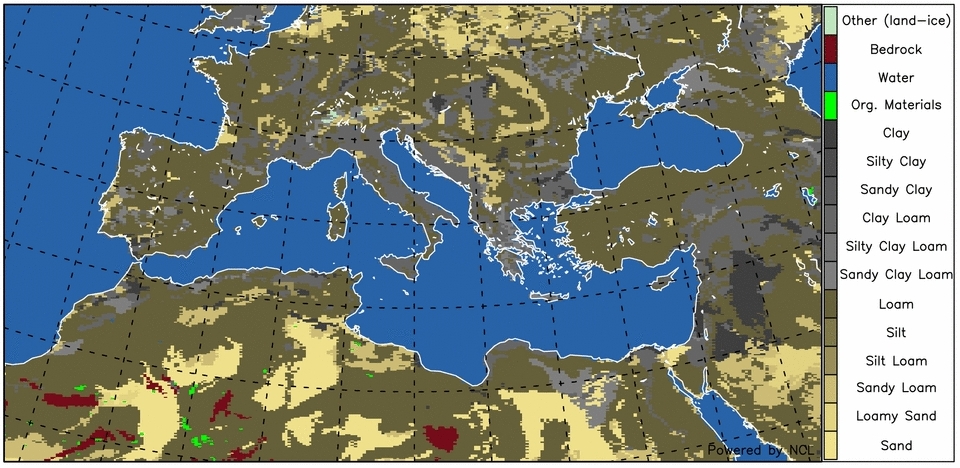
USGS DEM database (30x30sec) is used for the topography, 24 categories of the USGS (30x30sec) are used for the definition of the vegetation types, and 16 categories of the FAO (30x30sec) for the determination of soil type. Initial and boundary conditions are derived from the GFS/NCEP forecasting system on a 0.5°x0.5° resolution. Appropriate algorithms have been developed in order to produce the primitive model outputs on GRIB/GRIB2/NETCDF format.
Vegetation categories (24) of the operational domainSoil types (16) of the operational domain
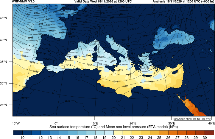
The current analysis of the sea surface temperature follows.
Sea surface temperature analysis [d01]
Dust model characteristics (WRF-Chem)
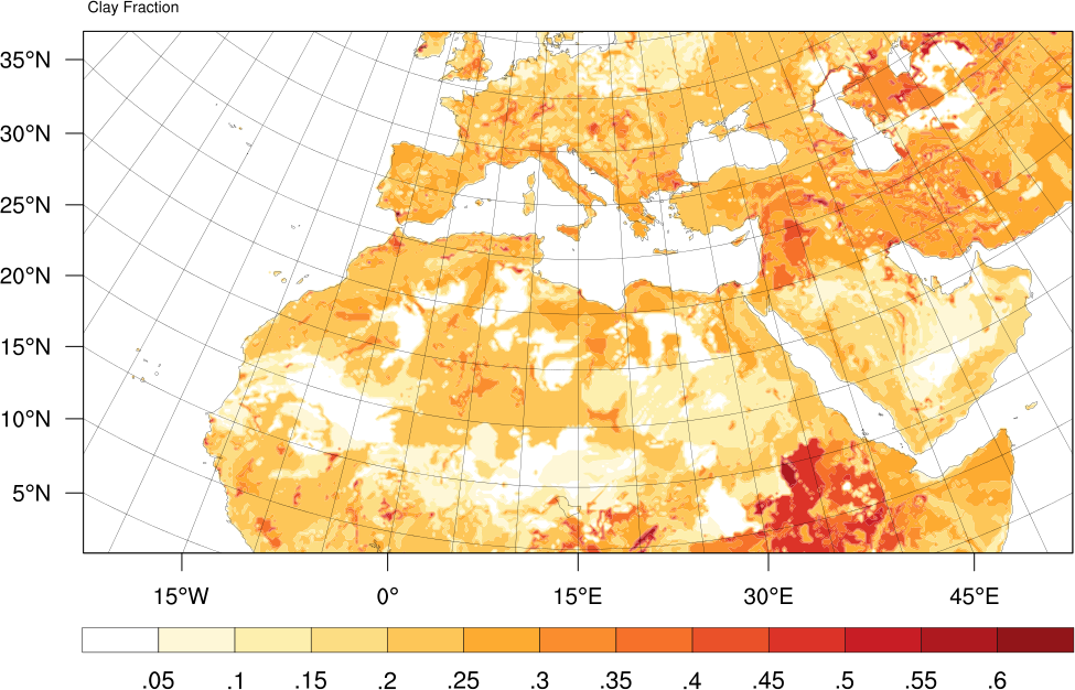
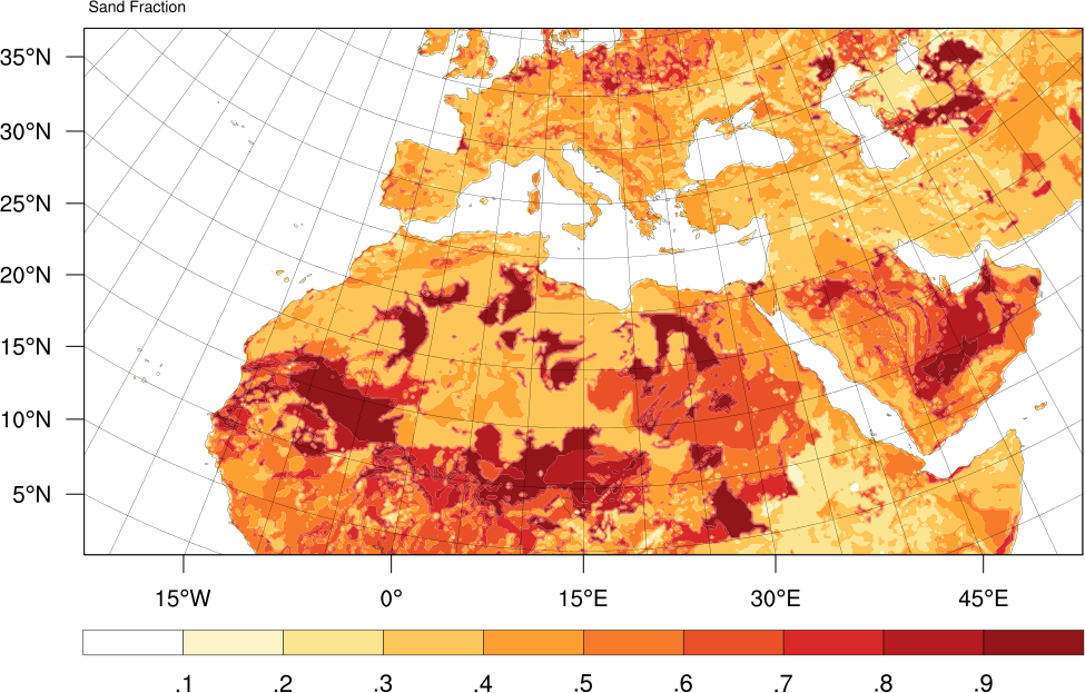
The limited area WRF-ARW-CHEM v3.6 meteorology-chemistry model has been installed and configured at the parallel computational infrastructure of the Geography Department of Harokopio University of Athens (HUA) since July 2014. The GOCART (Georgia Tech/Goddard Global Ozone Chemistry Aerosol Radiation and Transport model, Chin et al., JGR, 2000) aerosol module that is used has a sectional scheme for dust, providing forecast for five particle-size bins: 0.5, 1.4, 2.4, 4.5, 8.0 μm effective radius. The model produces a 120-hour (5 days) dust forecasts (near surface dust concentration, total dust load and dust dry deposition) covering the North Africa, Europe, Middle East and the Saudi Arabia peninsula. The operational domain is consisted of 400x212 grid points, on a 25x25 km grid distance, with 38 vertical levels up to 25 hPa. The dust sources are primarily derived from the clay and sand fraction databases.
Clay fraction databaseSand fraction database
The GOCART aerosol module has also a sectional scheme for sea salt, providing forecast for four particle-size bins: 0.3, 1.0, 3.2, 7.5 μm effective radius, concerning the entire dust operational domain. The calculation of the sea salt flux is based on the original formula by Monahan et. al (1986) which expresses the rate of seawater droplet generation per unit area of sea surface, per increment of particle radius and it reasonably predicts total sea-salt aerosol mass concentrations and their wind dependence (Gong, 2003) for sea-salt aerosols larger than 0.2 μm radius. The new version is better to represent emission of sub-micron sea salt particles and reduces the sea-salt number flux density below 0.2 μm radius. It also maintains the basic form of the original Monahan equation but adds a size-dependent exponential term for radius.
Chin, M., R. B. Rood, S.-J. Lin, J.-F. Müller, and A. M. Thompson (2000), Atmospheric sulfur cycle simulated in the global model GOCART: Model description and global properties, J. Geophys. Res., 105(D20), 24671–24687, doi:10.1029/2000JD900384.
Gong, S. L., A parameterization of sea-salt aerosol source function for sub- and super-micron particles, Global Biogeochem. Cycles, 17(4), 1097, doi:10.1029/2003GB002079, 2003.
Nowcasting (LAPS)
Nowcasting is a form of very short-range weather forecasting (usually up to 6 hours) based on very fine observational data (Kalnay, 2003). The provided nowcasting information is based on NOAA's Local Analysis and Prediction System (LAPS). It is a mesoscale meteorological data assimilation system that utilizes a suite of observations (e.g. surface meteorological stations, radar, satellite, soundings, and aircraft) to generate a spatially distributed, time-evolving, three-dimensional representation of atmospheric patterns and processes (Albers, 1995).
Currently, LAPS is running on two domains. The coarse one covers the entire Europe, Middle East and North Africa on a horizontal grid increment of 15 km (550x425 grid points) and 43 vertical levels. The finer one covers Greece on a horizontal grid increment of 3 km (700x320 grid points) and 43 vertical levels, as well. Early and final analyses are provided for both domains on hourly temporal increment. Early analyses are available 30 minutes after the analysis referenced hour and the final analyses about 55 minutes later. Near-to-analysis forecast, valid for the next hour, is also produced for both domains.
The system is based on the GFS analysis and near-to-analysis forecast data updated every 6 hours (4 forecast cycles on daily basis). It assimilates various types of surface and upper air observations (METAR, SYNOP, RAOBS) and satellite retrievals for the precipitation estimation. LAPS analyses have been evaluated against independent surface observations provided by a dense network of surface stations over Greece (Katsafados et al., 2012).
Albers, S., 1995: The LAPS wind analysis. Weather and Forecasting, 10, 342-352.
Kalnay, E., Atmospheric Modeling, Data Assimilation and Predictability. Cambridge University Press, 2003.
Katsafados P., A. Papadopoulos, K. Lagouvardos, V. Kotroni, E. Mavromatidis and I. Pytharoulis: Statistical evaluation of the Local Analysis and Prediction System over Greece. 2nd LAPS Users Workshop, October 23-25, 2012, Boulder CO, USA.